File:Pmmap.jpg
Jump to navigation
Jump to search
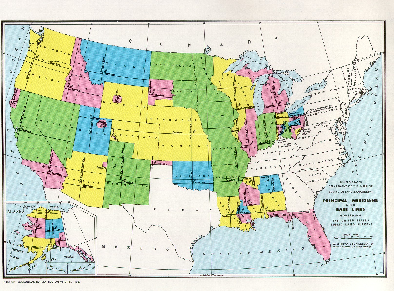
Size of this preview: 800 × 592 pixels. Other resolution: 1,616 × 1,196 pixels.
Original file (1,616 × 1,196 pixels, file size: 760 KB, MIME type: image/jpeg)
Summary
Licensing/Copyright status
This media, Pmmap.jpg, is in the public domain
You may freely copy, distribute, display and perform this work, as well as make derivative and commercial works.
File history
Click on a date/time to view the file as it appeared at that time.
| Date/Time | Thumbnail | Dimensions | User | Comment | |
|---|---|---|---|---|---|
| current | 19:52, 11 March 2022 | | 1,616 × 1,196 (760 KB) | Maintenance script (talk | contribs) | == Summary == Importing file |
You cannot overwrite this file.
File usage
The following 3 pages use this file: